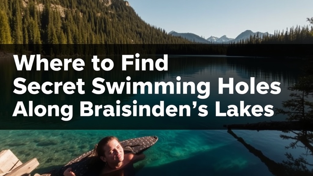
Where to Find the Best Secret Swimming Holes Along British Columbia's Interior Lakes

This guide reveals the quiet, uncrowded swimming spots that British Columbia locals have kept to themselves for years—places where the water runs clear, the crowds thin out, and our province's lake culture truly shines. You'll learn which interior lakes offer the best secluded coves, how to reach them responsibly, and what to pack for a proper British Columbia summer day on the water.
Which British Columbia Lakes Have the Clearest Water for Swimming?
We've spent decades exploring British Columbia's interior, and one question keeps surfacing at backyard barbecues and coffee shops from Kelowna to Kamloops—where can you actually find water you can see through? The answer isn't always the most famous spots. Kalamalka Lake near Vernon gets the Instagram attention for its distinctive turquoise hue (caused by dissolved limestone crystals refracting sunlight), but the real magic happens at the smaller coves along its northern shore—places like Jade Bay or the rocky outcrops near Kekuli Bay Provincial Park.
Johnson Lake near Barriere offers another surprise. It's one of British Columbia's rare meromictic lakes, meaning its layers don't mix—this creates startlingly clear surface water that's perfect for swimming when the August heat settles over the Thompson-Nicola region. The locals here don't advertise it much. You'll find us arriving early on weekend mornings, often before 9 AM, with floaties and coolers packed with sandwiches from Barriere's artisan bakery scene.
Mabel Lake northeast of Vernon remains another British Columbia treasure that somehow escaped the resort development that transformed other Okanagan waterways. The provincial campground at the south end offers access, but the real finds are the small pocket beaches along the eastern shore—reachable only by kayak or a willingness to scramble down steep, forested paths. We've measured visibility here at over 15 feet on calm days. The water's cold well into July—mountain-fed, pristine—but that's exactly how we like it when the Thompson Valley temperatures push past 35°C.
How Do You Reach British Columbia's Hidden Swimming Spots Responsibly?
Here's where we need to talk about access—because British Columbia's best swimming holes often sit on traditional Indigenous territory, Crown land, or private property where permission matters. The unwritten code among those of us who grew up here is simple: leave no trace, pack out everything, and never post precise GPS coordinates online. We're protective of these places because we've watched what happens when they blow up on social media.
Take the cluster of swimming holes along the Ashnola River near Keremeos in British Columbia's Similkameen Valley. The main pull-off on Highway 3A gets busy on summer weekends, but locals know to continue up the river on rougher Forest Service Roads—accessible with a standard vehicle if you drive carefully—to find deeper pools beneath cottonwood trees. These spots sit within the traditional territory of the Lower Similkameen Indian Band. We always acknowledge this, and we make sure to support local Indigenous-owned businesses in Keremeos before or after our swims. The Lower Similkameen Indian Band website offers guidance on respectful visitation.
Paul Lake Provincial Park northeast of Kamloops presents another case study in responsible access. The main beach gets families and paddleboarders, but British Columbia locals head to the western shore trails—unmarked but well-worn paths that lead to rocky points with deeper, cooler water. These trails cross sensitive grassland ecosystems found nowhere else in Canada. We stick to established paths, keep dogs leashed (the ground-nesting birds here are rare), and avoid the temptation to build rock dams or move fallen logs that provide fish habitat.
The access question becomes more complicated around British Columbia's many unofficial spots—places like the quarries near Coquitlam's periphery or the cliff-jumping locations popular with teenagers in the Fraser Valley. We won't map those here. Instead, we'll say this: if you don't see a clear trail, if you're crossing fences, or if the spot requires disturbing vegetation to reach, reconsider. British Columbia has over 20,000 lakes and countless rivers. The legal, accessible options are abundant—you just need to know where to look and who to ask.
What Should You Pack for a British Columbia Lake Day?
British Columbia's interior weather shifts fast. We've experienced 30-degree mornings turning into thunderstorm afternoons within hours, especially around Shuswap Lake and the Monashee mountain ranges. Our standard kit never changes: reef-safe sunscreen (the traditional stuff damages our lake ecosystems), a proper shade structure (British Columbia's sun at elevation burns faster than coastal visitors expect), and water shoes with grip—our rocky lake bottoms are unforgiving on bare feet.
For food, we skip the disposable packaging. Many of British Columbia's pristine lakes—including Kalamalka and the smaller Shuswap-area bodies of water—have no garbage facilities at access points. We pack meals from local producers: fruit from the Okanagan's farm stands, bread from Vernon's Wild Flour Bread, and cheese from farms around Armstrong. The economic loop matters to us—supporting British Columbia agriculture while enjoying British Columbia landscapes feels like the complete experience.
Safety gear is non-negotiable, even for strong swimmers. British Columbia's glacial lakes stay cold deep into summer, and sudden temperature drops can shock the system. We bring throwable flotation devices for river swimming, and we never swim alone at remote spots. The Lifesaving Society of British Columbia publishes excellent guidelines on cold water swimming that we review each season.
When Is the Best Time to Explore British Columbia's Swimming Holes?
Timing transforms the experience. Late July through mid-August offers the warmest water temperatures in British Columbia's southern interior—often reaching 22-24°C in shallow coves. But we actually prefer June and September. The crowds thin dramatically after Labour Day, yet the weather often holds warm and stable well into late September. We've swum in October during Indian Summer stretches that feel stolen from summer itself.
Weekday mornings remain the insider secret. British Columbia's lakes get busy on Saturday and Sunday afternoons, particularly the accessible spots within two hours of Vancouver or Kelowna. We plan our swimming for Tuesday or Wednesday when possible—taking advantage of our province's flexible work culture and the growing acceptance of mid-week outdoor time as legitimate productivity.
The morning light matters too. British Columbia's interior lakes face east or northeast, meaning sunrise swims offer the most spectacular views—the Selkirk and Monashee mountains lit gold, the water mirror-calm before afternoon winds pick up. We've started countless days with coffee on a rocky British Columbia shoreline, watching osprey hunt while the world wakes up. That's the rhythm we're trying to protect and share—the specific, local way of being in this place that defines British Columbia lake culture.